- Home
- About Us
- Canvas
- Echo Tech
- Kids Enclosure
- Gallery
- Team
- E-Services
- Contact Us
Thermal Technology
Thermal Technology: Revolutionizing Forest Management in Punjab
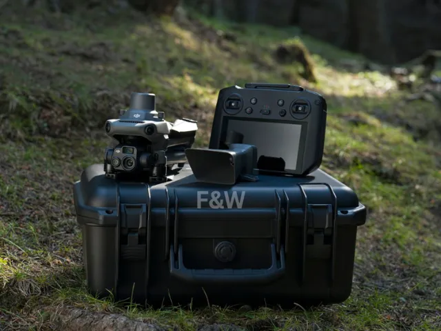
The Forest Department of Punjab is enhancing forest conservation and management through advanced thermal imaging technology, utilizing the DJI Mavic 3T drone for precise aerial surveillance. Equipped with a high-resolution thermal camera, the Mavic 3T enables real-time detection of heat anomalies, facilitating early wildfire identification, wildlife monitoring, and ecosystem assessment. This integration of drone-based thermal imaging improves operational efficiency in forest management, allowing rapid response to threats such as fires, illegal encroachment, and habitat disturbances. The technology supports data-driven decision-making, ensuring sustainable conservation efforts across forested regions.
Forest Fire Detection and Monitoring:
Thermal technology provides real-time detection of heat anomalies, enabling early identification of forest fires. By mapping fire-prone areas and monitoring fire spread, it supports rapid response and effective fire management strategies.
Ecosystem Health Assessment:
By detecting variations in vegetation temperature, thermal technology helps assess forest health, identifying stressed or diseased trees. This supports targeted interventions to maintain biodiversity and enhance forest resilience against climate change.