AI-Assisted Encroachment Identification
Using Technology to Protect Forest Resources
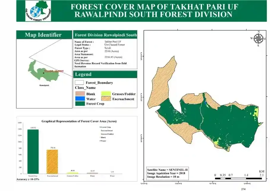
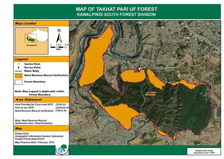
The Punjab Forest Department has introduced AI-assisted encroachment identification to detect illegal land use in forest areas. This cutting-edge method combines AI-based geospatial technology with revenue record digitalization to accurately identify and address encroachments in forest areas. By overlaying satellite imagery and revenue records, this system allows forest authorities to pinpoint areas that require further investigation and verification.
Key Features of the AI-Assisted Identification
Accurate Mapping: The forest map includes specific identifiers, showing areas of encroachment, water bodies, and forest boundaries. Revenue Record Verification: The map highlights areas that require additional revenue record validation to confirm their legal status. AI and Geo-Spatial Integration: Satellite imagery, along with GPS and AI tools, provides real-time data for precise forest management. This method ensures that forest boundaries are clearly defined, helping authorities take immediate action against illegal land occupation while ensuring the long-term preservation of forest resources. Punjab uses advanced technology to set a precedent for innovative, data-driven forest management.